

Woodgrove Geospatial Science Class is on the Road to James Madison University
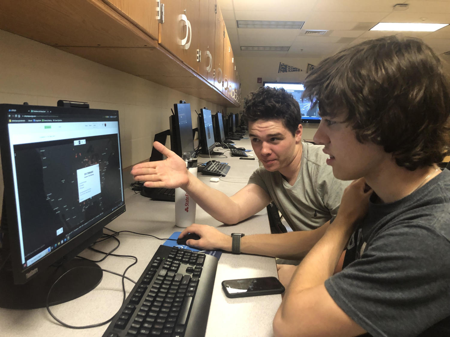
The WHS Geospatial science class field trip will be held at James Madison University on April 28. ArcGIS students will present projects to JMU professors and college students and will also tour the JMU campus.
This specific class field trip offers several learning opportunities.
“The ArcGIS class is really supposed to center around geospatial thinking; thinking about information and data collected, in terms of space location and relationship. Also, as it turns out, students get to learn the art of GIS software. I think this allows the students to become more aware of all the maps they see and understand how they work,” said Woodgrove Geospatial Science teacher Scott Fortney.
But the trip to JMU isn’t just a learning opportunity for Woodgrove students. As Mr. Fortney explains in detail, it’s also an adventure and full of countless experiences.
“It is fun to ride on nice buses and to experience the college campus. It’s nice to travel through the facilities and lecture rooms. We also go to the campus cafeteria, and students get to see how kids from other schools think differently about their projects. It’s also fun for students to sit with friends on the bus.”
The students of ArcGIS have also expressed excitement about their upcoming trip to JMU.
“It’s going to be cool to present what we worked so hard on in front of people who are professionals in the industry,” said sophomore Andrew Green.
Other students are looking forward to enjoying the sights of the campus more than the presentation itself.
Senior Steve Ky said, “I am most excited to see JMU and the fact I am looking at it more from a student perspective.”
While it’s a great opportunity for students to present to professionals in the field, some definitely feel the pressure.
“I am definitely nervous because I have never presented to an audience that big,” said senior Novi Voorhees.
Public speaking is nerve-wracking for many, but the students presenting have spent time practicing and preparing for their presentations. Despite some nervousness, Voorhees feels ready for the challenge.
“I think the presentation will help me with my public speaking skills. I really need that to give me a headstart on being ready to speak in public,” Voorhees said.
Senior Mahika Bhatt has a different perspective on the presentation.
“I am looking forward to having it finished and seeing how the project I created came into its own and to show it to the students and professors,” said Bhatt.
Students say that they really enjoy the class for many reasons. Mr. Fortney also expressed why the class is fun to take.
“I think it is cool because it is not a lecture class at all. The way I run the class is the students teach each other and run it together. The students also get to help each other. Some students may stand out more than others at times, but whoever can help the others out becomes kind of the hero for that day. Also, there’s more student collaboration and you’re not just spoon fed the work. A couple other perks are that there is really no homework and the six college credits are huge. ArcGIS is a skill that students can also apply to careers someday,” said Mr. Fortney.
Senior Jacob Sundberg has enjoyed the class and says he took it on the recommendation of his older sister.
“My sister and Mr. Fortney gave me information about this class and that’s what made me join. It sounded like a lot of fun, and it turns out it was a great outcome,” said Sundberg.
Senior Zack Earnshaw took the class because of his father’s influence.
“He works for Esri, which actually makes the ArcGIS software. Also, the credits really help too,” Earnshaw said.
Your donation will support the student journalists of Woodgrove High School. Your contribution will allow us to purchase equipment, attend conferences, and cover our annual printing and website hosting costs.